Understanding GPR Technology
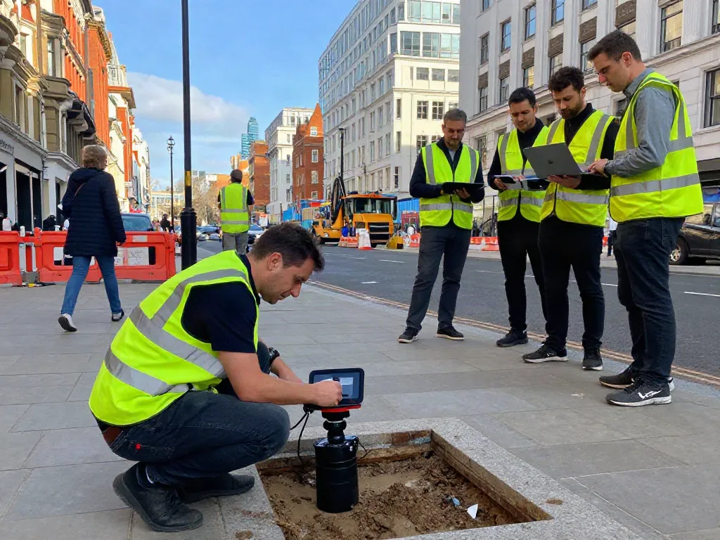
Ground Penetrating Radar (GPR) technology has emerged as a crucial tool in modern surveying, especially in urban environments like London. This non-invasive method allows for the effective detection and mapping of underground utilities, ensuring safety and precision in construction and excavation projects. In an era where infrastructure demands are continuously growing, understanding the potential of a GPR Utility Survey London provides stakeholders with the insights needed to enhance project outcomes and minimize risks.
What is GPR Utility Survey London?
GPR Utility Survey refers to the use of Ground Penetrating Radar technology to identify and map underground utilities, such as pipes, cables, and other structures. This survey technique employs radar pulses to penetrate the ground and reflect off subsurface materials, creating images that depict various layers and objects. These surveys are particularly essential in densely populated areas like London, where buried utilities are often numerous and critical to safety and project management.
How Does GPR Work?
The GPR system consists of a transmitter that generates radar waves and a receiver that captures the reflected signals. When the radar waves encounter different materials underground, such as soil, concrete, or metal, they reflect back to the receiver. The data is then processed to create tomographic images that reveal the subsurface layout. GPR can operate at varying frequencies, with lower frequencies penetrating deeper but offering less resolution, while higher frequencies provide more detail but cover less depth.
Benefits of Using GPR in Urban Areas
Utilizing GPR technology in urban settings yields numerous benefits, including:
- Non-destructive testing: Unlike traditional methods, GPR is non-invasive, minimizing disruption to surface structures and landscaping.
- Real-time data acquisition: GPR can provide immediate results, allowing for quick decision-making during projects.
- High accuracy: GPR offers detailed images of subsurface features, enhancing the ability to identify potential issues before they occur.
- Cost-effectiveness: By preventing accidental damage to utilities, GPR can save significant costs associated with repairs and project delays.
Who Requires GPR Utility Surveys?
Construction Companies and Contractors
In the construction industry, GPR surveys are invaluable for ensuring that projects proceed without unforeseen complications. Contractors can leverage GPR data to plan excavations accurately, avoiding existing underground utilities that could otherwise be damaged, leading to costly delays.
Public Utility Providers
Utility companies often rely on GPR surveys to manage their infrastructure effectively. By mapping out the location of existing services, providers can implement maintenance and upgrade strategies with greater efficiency, ensuring uninterrupted service for customers.
Environmental and Engineering Consultants
Consultants in environmental and civil engineering fields utilize GPR to assess subsurface conditions and implement necessary environmental impact assessments. The ability to accurately locate buried materials helps in making informed decisions about land use, remediation, and sustainability practices.
Challenges in Implementing GPR Surveys
Understanding Underground Infrastructure
One of the primary challenges in GPR surveys is the complex nature of urban underground infrastructure. Each city has a unique layout of utilities, and understanding this complexity is crucial for accurate mapping and interpretation.
Weather and Environmental Concerns
Environmental factors such as moisture content and soil composition can affect GPR effectiveness. For example, wetter soils can lead to a higher attenuation of radar signals, potentially reducing the clarity of the data acquired.
Interpreting GPR Data Accurately
The accurate interpretation of GPR data requires trained professionals who understand the intricacies of the technology and how to relate the findings to geological and civil engineering concepts. Inexperienced interpretation may lead to incorrect conclusions about the subsurface conditions.
Best Practices for GPR Utility Surveys
Preparation and Site Assessment
Thorough site preparation is essential before conducting a GPR survey. This includes gathering existing utility maps, understanding local geology, and preparing the site to enhance data acquisition quality.
Collaboration with Local Authorities
Engaging with local authorities can significantly benefit GPR surveys. Having access to up-to-date utility maps and historical excavation data can improve the survey's accuracy and reliability.
Effective Data Analysis and Reporting
Once GPR data is collected, it is crucial to employ advanced data analysis techniques. This will ensure that the findings are reported in a manner that aligns with industry standards and can be readily understood by stakeholders.
Future Trends in GPR Utility Surveying
Technological Advancements in GPR Equipment
As technology advances, GPR equipment is becoming increasingly sophisticated, with improvements in data processing and signal clarity. The future will see the integration of AI and machine learning to enhance the interpretation speed and precision of GPR data.
Integration with Other Surveying Methods
Future GPR surveys are likely to incorporate data from other non-invasive techniques, such as electromagnetic induction and acoustic surveying, providing a more comprehensive view of the subsurface environment.
Predictions for GPR Use in 2026 and Beyond
With urban development continuing to escalate, the demand for GPR utility surveys is expected to rise. By 2026, advancements in survey technology may lead to increased adoption of GPR in various sectors, from real estate development to environmental protection.
What are the Costs Associated with GPR Surveys?
Costs for GPR surveys can vary depending on project size, location, and complexity. Typically, GPR surveys are an investment that can save money in the long run by preventing utility damage and project delays.
How Accurate are GPR Surveys Compared to Traditional Methods?
GPR surveys are generally more accurate than traditional methods due to their ability to provide real-time, high-resolution images of subsurface conditions. While traditional methods rely on surface-level indicators, GPR can penetrate deeper and provide a clearer picture of underground infrastructure.
What Industries Benefit Most from GPR Utility Surveys?
Several industries can benefit from GPR utility surveys, including construction, civil engineering, environmental consulting, and public utilities. Each of these sectors can leverage GPR data to enhance project safety and efficiency.
How Long Does a GPR Survey Take?
The duration of a GPR survey can vary significantly based on the project's scope. Smaller sites may require only a few hours, while larger or more complex areas may take several days to fully survey.
What are the Necessary Certifications for GPR Operators?
Operators of GPR equipment typically require specific training and certifications. This ensures they have the necessary skills to conduct surveys accurately and interpret data reliably, maintaining high industry standards.